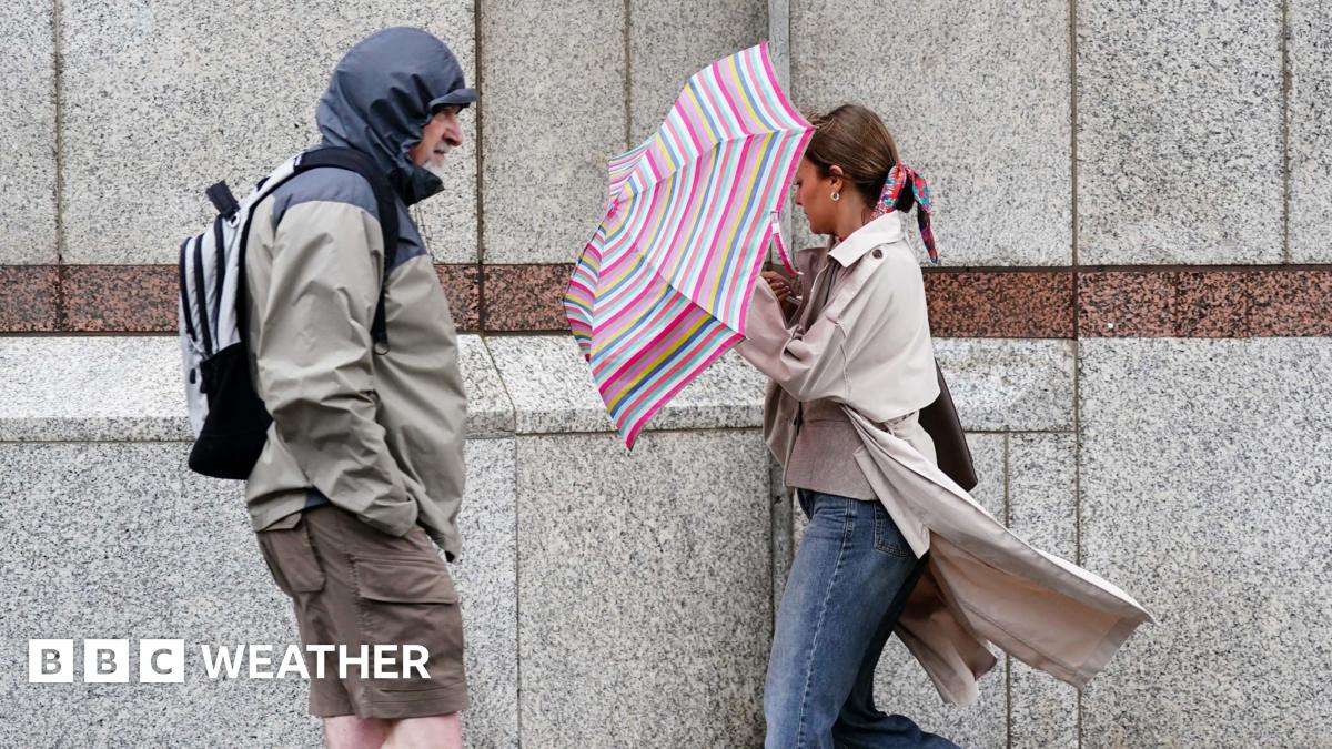
Wind and rain to lash UK this weekend as Met Office issues weather warnings

Met Office yellow warnings for rain have been issued across parts of the UK as a developing area of low pressure looks set to dominate the weekend weather.
Areas of Northern Ireland, Scotland, northern England and Wales are covered by the warnings which run from Saturday morning until early on Sunday.
Flooding and travel disruption are possible, with this latest dose of rain coming after a very wet September so far. There is also the threat of gales around Irish Sea coasts.
After a brief burst of warmth on Friday, temperatures are expected to drop significantly over the weekend.
How much rain will there be?
One Met Office warning covers southern Scotland, as far north as Edinburgh, Glasgow and the Central Belt.
Large parts of northern England are also covered, as well as the north and west of Wales.
Within the warning area 20-40mm (0.8-1.6in) of rain is expected to fall widely, with the possibility of 75-100mm (3.0-3.9in) over high ground.
The warning is valid from 09:00 (BST) on Saturday until 06:00 on Sunday.

Gusty winds and thunder may accompany the rain increasing the risk of disruption
The other yellow warning is for eastern parts of Northern Ireland and covers a slightly shorter period, from 12:00 (BST) on Saturday until 03:00 on Sunday.
Around 20-40mm of rain is also likely here, with 60-80mm (2.4-3.1mm) on hills and mountains.
Computer weather models are not entirely in agreement about where the wettest of the weather will be so it is possible that some areas of Northern Ireland will avoid the worst of the rain.
However, rainfall totals like these bring a risk of localised flooding, surface water and spray on roads, and possible delays on the railways.

Roads around Swansea were blocked by flooding after heavy rain earlier this month
The impacts could be worse than usual because of how much wet weather we have seen this September.
Some places have already recorded double the rainfall they would typically expect during the whole month.
It has been a marked a big change after the UK’s hottest summer on record.
Risk of gales in the west
An area of low pressure is, perhaps unsurprisingly, going to be responsible for the heavy rain.
It will be deepening as it moves across the UK and, while there is some uncertainty about just how intense it will become, there is a risk that gales could develop in the west.
Gusts of 60-70mph (97-113km/h) are possible around Irish Sea coasts on Saturday afternoon and evening.
This could bring further travel impacts.
A temperature see-saw
Ahead of the area of low pressure some areas will see a short, sharp burst of warmth on Friday.
Southerly winds will bring warm and humid air from continental Europe with temperatures likely to reach 26C (79F) in eastern England.
Northern and western parts of the UK will not get quite that warm but highs of 21C (70F) are forecast for parts of Wales, with 19C (66F) expected in north-east Scotland.
However, that warmth will not last long.

Maximum temperatures will drop by 10C in some locations
Brisk northerly winds will develop for the second half of the weekend bringing much cooler air southwards.
Afternoon highs of just 11-16C (52-61F) are likely – below the September average.
It will feel particularly chilly in areas that continue to see outbreaks of rain.
These cooler conditions are forecast to stay with us into the start of next week.
However, high pressure looks likely to build so things should become a little drier, at least for a time.
Keep up to date with our latest thoughts on the longer-term forecast by checking our monthly outlook.


إرسال التعليق